| Auther | : Michael Goodchild |
| Number of Pages | : 354 |
| Size of file | : 5.64MB |
| book quality | : Good |
| Section | : Geography |
| Department | : Social sciences |
| Date of Coming | : 2022-08-10 |
| Language | : English |
Author: Michael Goodchild
About the Author: Michael F. Goodchild is Professor of Geography at the University of California, Santa Barbara; Chair of the Executive Committee, National Center for Geographic Information and Analysis (NCGIA); Associate Director of the Alexandria Digital Library Project; and Director of NCGIA’s Center for Spatially Integrated Social Science. He received his BA degree from Cambridge University in Physics in 1965 and his PhD in Geography from McMaster University in 1969. After 19 years at the University of Western Ontario, he moved to Santa Barbara in 1988. He was Director of NCGIA from 1991 to 1997. He was elected member of the National Academy of Sciences and Foreign Fellow of the Royal Society of Canada in 2002, and member of the American Academy of Arts and Sciences in 2006. He has received honorary doctorates from Laval University (1999), Keele University (2001), McMaster University (2004), and Ryerson University (2004). In 1990 he was given the Canadian Association of Geographers Award for Scholarly Distinction, in 1996 the Association of American Geographers award for Outstanding Scholarship, in 1999 the Canadian Cartographic Association’s Award of Distinction for Exceptional Contributions to Cartography, and in 2002 the Educator of the Year Award from the University Consortium for Geographic Information Science. In 2001 he received a Lifetime Achievement Award from Environmental Systems Research Institute, Inc. He was Editor of Geographical Analysis between 1987 and 1990 and Editor of the Methods, Models, and Geographic Information Sciences section of the Annals of the Association of Americal Geographers from 2000 to 2006. He serves on the editorial boards of ten other journals and book series. His major publications include Accuracy of Spatial Databases (1989); Geographical Information Systems: Principles and Applications (1991); Environmental Modeling with GIS (1993); GIS and Environmental Modeling: Progress and Research Issues (1996); Scale in Remote Sensing and GIS (1997); Interoperating Geographic Information Systems (1999); Geographical Information Systems: Principles, Techniques, Management and Applications (1999); Geographic Information Systems and Science (2001 and 2005); Spatial Uncertainty in Ecology (2001); Spatial Data Quality (2002); Uncertainty in Geographical Information (2002); Foundations of Geographic Information Science (2003); Spatially Integrated Social Science (2004); and GIS, Spatial Analysis, and Modeling (2005); in addition he is author of some 350 scientific papers. He was Chair of the National Research Council’s Mapping Science Committee from 1997 to 1999; and is currently a member of NRC’s Geographic Science Committee. His current research interests center on geographic information science, spatial analysis, and uncertainty in geographic data.
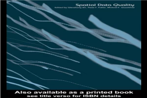
Spatial Data Quality book pdf download By Michael Goodchild
As research in the geosciences and social sciences becomes increasingly dependent on computers, applications such as geographical information systems are becoming indispensable tools. But the digital representations of phenomena that these systems require are often of poor quality, leading to inaccurate results, uncertainty, error propagation, and potentially legal liability. Spatial data quality has become an essential research topic within geographical information science.This book covers many of the cutting-edge research issues related to spatial data quality, including measurement in GIS and geostatistics, the modeling of spatial objects that have inherent uncertainty, spatial data quality control, quality management, communicating uncertainty and resolution, reasoning and decision-making, visualization of uncertainty and error metadata. Spatial Data Quality will be of interest to anyone undertaking research using GIS and related technologies.
Download PDF of Spatial Data Quality book pdf download By Michael Goodchild
-Adrian Agency Library